


 Deutsch
 Nederlands
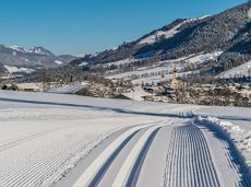
Hausbach stream circuit

Ideal circuit for beginners to start exercising
Tourist Information Office, Going (766 m)
Tourist Information Office, Going (766 m)
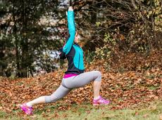
Jogging
Easy
0:20 h
3,1 km
75 Elevation gain
The tour recommendations listed here are based on the current weather conditions.
However, we would like to point out that the weather and therefore the conditions can change quickly and that every tour is undertaken at your own risk.
Ideal circuit for beginners to start exercising
Tourist Information Office, Going (766 m)
Tourist Information Office, Going (766 m)
Jogging
Easy
0:20 h
3,1 km
75 Elevation gain
Old path - now renovated and featuring a pleasant series of ascents and descents.
Hiking starting point Bergbahn, Söll (725 m)
Hiking starting point Bergbahn, Söll (725 m)
Hiking
Intermediate
4:30 h
13,5 km
470 Elevation gain

Varied beginner trail round between the Kaiser towns of Ellmau and Going.
Wanderstartplatz Tourismus Info, Ellmau
Wanderstartplatz Tourismus Info, Ellmau
Jogging
Easy
9,7 km
500 Elevation gain

Stripsenjochhaus - Griesner Alm - Griesenau
Stripsenjochhaus (1,577 m)
Griesenau, Kirchdorf (719 m)
Hiking
Intermediate
3:00 h
7,9 km

Stripsenjochhaus – Eggersteig – Steinerne Rinne – Ellmauer Tor – Jubiläumssteig – Gruttenhütte
Stripsenjochhaus, St. Johann in Tirol (1,577 m)
Gaudeamushütte, Going (1,263 m)
Hiking
Difficult
5:00 h
6,3 km
590 Elevation gain

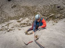
60-metre high rock dome – the Mecca for extreme climbers
Route number226
Access time1,25
Sport climbing

The circuit around Going is a lengthy and demanding tour with a great variety of different sections.
Tourist Information Office, Going (766 m)
Tourist Information Office, Going (766 m)
Jogging
Intermediate
1:25 h
11,2 km
280 Elevation gain
 Partially open
Family roundtrip through the Rebachklamm to the Seilabodenkreuz, via the Kaiseralm and the Jägerwirt back to the center of Scheffau.
Community Hall, Scheffau (740 m)
Community Hall, Scheffau (740 m)
Hiking
Intermediate
3:15 h
9,7 km
510 Elevation gain
Number of rope lengths5
Access time2,0
Alpine climbing route
Multi-rope length difficulty levels7+

Hike to the Gaudeamushütte mountain hut by the Wilder Kaiser
Wochenbrunner Alm, Ellmau (1,085 m)
Gaudeamushütte, Going (1,263 m)
Hiking
Easy
0:35 h
1,3 km
175 Elevation gain
A tour of the main filming locations of the TV series “Der Bergdoktor” (The Mountain Doctor) in Ellmau and Going, with a refreshment stop at the inn used during filming
Hiking info point, Tourist Info Ellmau (800 m)
Hiking info point, Tourist Info Ellmau (800 m)
Hiking
Easy
3:15 h
11,4 km
180 Elevation gain

The viewpoint mountain of the locals, steep and fascinating.
Hiking starting point Alpenschlössl, Söll (762 m)
Hiking starting point Alpenschlössl, Söll (762 m)
Hiking
Intermediate
5:00 h
10,4 km
790 Elevation gain

Savour the wonder of the winter landscape – experience the winter magic for yourself by crunching through the pristine snow with your snowshoes. Enjoy unique impressions and experiences as you explore the white winter splendour and take in the spectacular view over the surrounding mountain scenery.
Church square, Going (769 m)
Church square, Going (769 m)
Hiking
1:30 h
2,9 km
110 Elevation gain

Refreshing walk through the Kneipp circuit and adventures in the Rehbachklamm gorge
Hiking starting point Tourist Info, Scheffau (738 m)
Hiking starting point Tourist Info, Scheffau (738 m)
Hiking
Intermediate
2:00 h
7,1 km
330 Elevation gain

Looping the village of Söll, the sight seeing hike!
Hiking starting point Tourist Info, Söll (689 m)
Hiking starting point Tourist Info, Söll (689 m)
Hiking
Easy
1:00 h
3,7 km
50 Elevation gain
A moderately challenging panoramic circuit around the Astberg mountain.
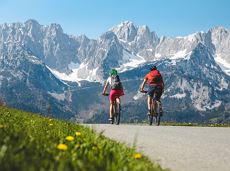
Tourist Info, Going (764 m)
Tourist Info, Going (764 m)
Cycling
Intermediate
15,3 km
480 Elevation gain

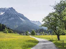
Scenic and varied circular hike.
Hiking starting point Going center (former tourist information Going) (764 m)
Hiking starting point Going center (former tourist information Going) (764 m)
Hiking
Intermediate
4:00 h
11,0 km
500 Elevation gain

Gruttenhütte - Kaiser-Hochalm - Steiner-Hochalm - Jägersteig - Walleralm - Hochegg - Kaindlhütte
Gruttenhütte, Ellmau (1,620 m)
Hintersteiner See, Scheffau (889 m)
Hiking
Intermediate
5:30 h
13,5 km
560 Elevation gain

Exciting adventure stations for family tobogganing on the Hohe Salve.
Cable car valley station, Söll (725 m)
Cable car valley station, Söll (725 m)
Tobogganing
Easy
4,0 km

31 routes, including 14 multi-pitch.
Route number32
Access time1,5
Sport climbing

Pure adrenaline is the motto of the Pölven trail on the third day of the Tour de Tirol
Hiking starting point Tourist Info, Söll (689 m)
Hiking starting point Tourist Info, Söll (689 m)
Jogging
Intermediate
22,8 km
1110 Elevation gain

Family-friendly, leisurely circular hike around the Astberg mountain
Astberg mountain station, Going (1.251 m)
Astberg mountain station, Going (1.251 m)
Hiking
Easy
0:30 h
1,5 km
80 Elevation gain
Ellmau hiking info - Gasthof Au - Forstmeile Ellmau
District "Steinerner Tisch", Ellmau
District "Steinerner Tisch", Ellmau
Jogging
Easy
1,9 km
75 Elevation gain
Number of rope lengths3
Access time2,0
Alpine climbing route
Multi-rope length difficulty levels7-

Short, promising cross-country ski circuit with combination options.
Cross-country skiing
Intermediate
2,2 km
40 Elevation gain

The largest bouldering hall in the Tirolean Unterland region.
Climbing room
 Open
OpenAccess time0,16666666666666666
Via ferrata
Difficulty levelD
Via ferrara length250,0 m

Details about the Kaiserkrone Trail - Trailrunning Event at: www.kaiserkrone.run
Start & Finish - village center of Scheffau (732 m), address: Dorf 45, 6351 Scheffau
Start & Finish - village center of Scheffau (732 m), address: Dorf 45, 6351 Scheffau
Jogging
Intermediate
20,7 km
1290 Elevation gain

The Kitzbüheler Horn Via Ferrata offers a Magnificent Climbing Adventure for Less Experienced Climbers. Enjoy Spectacular Views and Adrenaline Rushes while being Safe and Secure throughout Your Journey.
Via ferrata

Enjoy unique panoramic views of the impressive mountains from the Biedringer Platte plateau.
Hiking starting point Tourist Info, Ellmau (800 m)
Hiking starting point Tourist Info, Ellmau (800 m)
Hiking
Easy
4:15 h
12,6 km
470 Elevation gain

Beautiful, Alpine sport climbing with consistent difficulty.
Number of rope lengths11
Access time2,0
Alpine climbing route
Multi-rope length difficulty levels7-

Explore the sunny foot of the Pölven mountain.
Hiking starting point Franzlhof, Söll (703 m)
Hiking starting point Franzlhof, Söll (703 m)
Hiking
2:30 h
6,8 km
100 Elevation gain

Beautiful hike around the Hintersteiner See lake and to a small alpine village.
Hiking starting point Seestüberl, Scheffau (889 m)
Hiking starting point Seestüberl, Scheffau (889 m)
Hiking
Easy
3:45 h
12,3 km
350 Elevation gain
 Open
OpenDifficulty D - two sections and a spectacular two-rope bridge.
Access time1,25
Via ferrata
Difficulty levelD
Via ferrara length300,0 m
Explore the village Scheffau on a circuit run
Starting point Scheffau Tourist Information Office (752 m)
Starting point Scheffau Tourist Information Office (752 m)
Jogging
Easy
5,6 km
120 Elevation gain
Embark on a sunny cross-country safari in the snowfields around the Sölllandl.
Spar super market Söll
Spar super market Söll
Cross-country skiing
Intermediate
5,9 km
70 Elevation gain
 Partially open
Hartkaiserbahn summit station - Ellmis Zauberwald - Tanzbodensee lake - Hartkaiserbahn summit station
Hartkaiser summit station, Ellmau (1,555 m)
Hartkaiser summit station, Ellmau (1,555 m)
Jogging
Easy
3,4 km
120 Elevation gain
 Partially open
Following the Stampfangerbach stream on the way to Filzalm lake
Hiking starting point Bergbahn, Söll (725 m)
Hiking starting point Bergbahn, Söll (725 m)
Hiking
Intermediate
3:15 h
9,0 km
620 Elevation gain

Sports ground, Söll (687 m)
Sports ground, Söll (687 m)
Jogging
Easy
3,0 km
70 Elevation gain

Hikers, young and old alike, will find in this wild romantic gorge natural playgrounds such as bridges and balancing beams by streams and ponds.
Hiking starting point Tourist Info, Scheffau (738 m)
Hiking starting point Tourist Info, Scheffau (738 m)
Hiking
Easy
1:15 h
3,5 km
130 Elevation gain
The tour recommendations listed here are based on the current weather conditions.
However, we would like to point out that the weather and therefore the conditions can change quickly and that every tour is undertaken at your own risk.
Ideal circuit for beginners to start exercising
Tourist Information Office, Going (766 m)
Tourist Information Office, Going (766 m)
Jogging
Easy
0:20 h
3,1 km
75 Elevation gain
Old path - now renovated and featuring a pleasant series of ascents and descents.
Hiking starting point Bergbahn, Söll (725 m)
Hiking starting point Bergbahn, Söll (725 m)
Hiking
Intermediate
4:30 h
13,5 km
470 Elevation gain
Varied beginner trail round between the Kaiser towns of Ellmau and Going.
Wanderstartplatz Tourismus Info, Ellmau
Wanderstartplatz Tourismus Info, Ellmau
Jogging
Easy
9,7 km
500 Elevation gain
Stripsenjochhaus - Griesner Alm - Griesenau
Stripsenjochhaus (1,577 m)
Griesenau, Kirchdorf (719 m)
Hiking
Intermediate
3:00 h
7,9 km
Stripsenjochhaus – Eggersteig – Steinerne Rinne – Ellmauer Tor – Jubiläumssteig – Gruttenhütte
Stripsenjochhaus, St. Johann in Tirol (1,577 m)
Gaudeamushütte, Going (1,263 m)
Hiking
Difficult
5:00 h
6,3 km
590 Elevation gain
60-metre high rock dome – the Mecca for extreme climbers
Route number226
Access time1,25
Sport climbing
The circuit around Going is a lengthy and demanding tour with a great variety of different sections.
Tourist Information Office, Going (766 m)
Tourist Information Office, Going (766 m)
Jogging
Intermediate
1:25 h
11,2 km
280 Elevation gain
Partially openFamily roundtrip through the Rebachklamm to the Seilabodenkreuz, via the Kaiseralm and the Jägerwirt back to the center of Scheffau.
Community Hall, Scheffau (740 m)
Community Hall, Scheffau (740 m)
Hiking
Intermediate
3:15 h
9,7 km
510 Elevation gain
Number of rope lengths5
Access time2,0
Alpine climbing route
Multi-rope length difficulty levels7+
Hike to the Gaudeamushütte mountain hut by the Wilder Kaiser
Wochenbrunner Alm, Ellmau (1,085 m)
Gaudeamushütte, Going (1,263 m)
Hiking
Easy
0:35 h
1,3 km
175 Elevation gain
A tour of the main filming locations of the TV series “Der Bergdoktor” (The Mountain Doctor) in Ellmau and Going, with a refreshment stop at the inn used during filming
Hiking info point, Tourist Info Ellmau (800 m)
Hiking info point, Tourist Info Ellmau (800 m)
Hiking
Easy
3:15 h
11,4 km
180 Elevation gain
The viewpoint mountain of the locals, steep and fascinating.
Hiking starting point Alpenschlössl, Söll (762 m)
Hiking starting point Alpenschlössl, Söll (762 m)
Hiking
Intermediate
5:00 h
10,4 km
790 Elevation gain
Savour the wonder of the winter landscape – experience the winter magic for yourself by crunching through the pristine snow with your snowshoes. Enjoy unique impressions and experiences as you explore the white winter splendour and take in the spectacular view over the surrounding mountain scenery.
Church square, Going (769 m)
Church square, Going (769 m)
Hiking
1:30 h
2,9 km
110 Elevation gain
Refreshing walk through the Kneipp circuit and adventures in the Rehbachklamm gorge
Hiking starting point Tourist Info, Scheffau (738 m)
Hiking starting point Tourist Info, Scheffau (738 m)
Hiking
Intermediate
2:00 h
7,1 km
330 Elevation gain
Looping the village of Söll, the sight seeing hike!
Hiking starting point Tourist Info, Söll (689 m)
Hiking starting point Tourist Info, Söll (689 m)
Hiking
Easy
1:00 h
3,7 km
50 Elevation gain
A moderately challenging panoramic circuit around the Astberg mountain.
Tourist Info, Going (764 m)
Tourist Info, Going (764 m)
Cycling
Intermediate
15,3 km
480 Elevation gain
Scenic and varied circular hike.
Hiking starting point Going center (former tourist information Going) (764 m)
Hiking starting point Going center (former tourist information Going) (764 m)
Hiking
Intermediate
4:00 h
11,0 km
500 Elevation gain
Gruttenhütte - Kaiser-Hochalm - Steiner-Hochalm - Jägersteig - Walleralm - Hochegg - Kaindlhütte
Gruttenhütte, Ellmau (1,620 m)
Hintersteiner See, Scheffau (889 m)
Hiking
Intermediate
5:30 h
13,5 km
560 Elevation gain
Exciting adventure stations for family tobogganing on the Hohe Salve.
Cable car valley station, Söll (725 m)
Cable car valley station, Söll (725 m)
Tobogganing
Easy
4,0 km
31 routes, including 14 multi-pitch.
Route number32
Access time1,5
Sport climbing
Pure adrenaline is the motto of the Pölven trail on the third day of the Tour de Tirol
Hiking starting point Tourist Info, Söll (689 m)
Hiking starting point Tourist Info, Söll (689 m)
Jogging
Intermediate
22,8 km
1110 Elevation gain
Family-friendly, leisurely circular hike around the Astberg mountain
Astberg mountain station, Going (1.251 m)
Astberg mountain station, Going (1.251 m)
Hiking
Easy
0:30 h
1,5 km
80 Elevation gain
Ellmau hiking info - Gasthof Au - Forstmeile Ellmau
District "Steinerner Tisch", Ellmau
District "Steinerner Tisch", Ellmau
Jogging
Easy
1,9 km
75 Elevation gain
Number of rope lengths3
Access time2,0
Alpine climbing route
Multi-rope length difficulty levels7-
Short, promising cross-country ski circuit with combination options.
Cross-country skiing
Intermediate
2,2 km
40 Elevation gain
The largest bouldering hall in the Tirolean Unterland region.
Climbing room
OpenAccess time0,16666666666666666
Via ferrata
Difficulty levelD
Via ferrara length250,0 m
Details about the Kaiserkrone Trail - Trailrunning Event at: www.kaiserkrone.run
Start & Finish - village center of Scheffau (732 m), address: Dorf 45, 6351 Scheffau
Start & Finish - village center of Scheffau (732 m), address: Dorf 45, 6351 Scheffau
Jogging
Intermediate
20,7 km
1290 Elevation gain
The Kitzbüheler Horn Via Ferrata offers a Magnificent Climbing Adventure for Less Experienced Climbers. Enjoy Spectacular Views and Adrenaline Rushes while being Safe and Secure throughout Your Journey.
Via ferrata
Enjoy unique panoramic views of the impressive mountains from the Biedringer Platte plateau.
Hiking starting point Tourist Info, Ellmau (800 m)
Hiking starting point Tourist Info, Ellmau (800 m)
Hiking
Easy
4:15 h
12,6 km
470 Elevation gain
Beautiful, Alpine sport climbing with consistent difficulty.
Number of rope lengths11
Access time2,0
Alpine climbing route
Multi-rope length difficulty levels7-
Explore the sunny foot of the Pölven mountain.
Hiking starting point Franzlhof, Söll (703 m)
Hiking starting point Franzlhof, Söll (703 m)
Hiking
2:30 h
6,8 km
100 Elevation gain
Beautiful hike around the Hintersteiner See lake and to a small alpine village.
Hiking starting point Seestüberl, Scheffau (889 m)
Hiking starting point Seestüberl, Scheffau (889 m)
Hiking
Easy
3:45 h
12,3 km
350 Elevation gain
OpenDifficulty D - two sections and a spectacular two-rope bridge.
Access time1,25
Via ferrata
Difficulty levelD
Via ferrara length300,0 m
Explore the village Scheffau on a circuit run
Starting point Scheffau Tourist Information Office (752 m)
Starting point Scheffau Tourist Information Office (752 m)
Jogging
Easy
5,6 km
120 Elevation gain
Embark on a sunny cross-country safari in the snowfields around the Sölllandl.
Spar super market Söll
Spar super market Söll
Cross-country skiing
Intermediate
5,9 km
70 Elevation gain
Partially openHartkaiserbahn summit station - Ellmis Zauberwald - Tanzbodensee lake - Hartkaiserbahn summit station
Hartkaiser summit station, Ellmau (1,555 m)
Hartkaiser summit station, Ellmau (1,555 m)
Jogging
Easy
3,4 km
120 Elevation gain
Partially openFollowing the Stampfangerbach stream on the way to Filzalm lake
Hiking starting point Bergbahn, Söll (725 m)
Hiking starting point Bergbahn, Söll (725 m)
Hiking
Intermediate
3:15 h
9,0 km
620 Elevation gain
Sports ground, Söll (687 m)
Sports ground, Söll (687 m)
Jogging
Easy
3,0 km
70 Elevation gain
Hikers, young and old alike, will find in this wild romantic gorge natural playgrounds such as bridges and balancing beams by streams and ponds.
Hiking starting point Tourist Info, Scheffau (738 m)
Hiking starting point Tourist Info, Scheffau (738 m)
Hiking
Easy
1:15 h
3,5 km
130 Elevation gain