


 Deutsch
 English
Marketplace tour Stöcklalm

Experience culinaric highlights for the whole family.
Bergstation Rabennest (1.150 m)
Bergstation Rabennest (1.150 m)
Wandelen
Gemakkelijk
0:40 u
1,7 km
90 Hoogtemeters
De door u opgevraagde pagina is niet beschikbaar. U bent welkom om een nieuwe zoekopdracht op deze pagina te starten.
De door u opgevraagde pagina is niet beschikbaar. U bent welkom om een nieuwe zoekopdracht op deze pagina te starten.
Experience culinaric highlights for the whole family.
Bergstation Rabennest (1.150 m)
Bergstation Rabennest (1.150 m)
Wandelen
Gemakkelijk
0:40 u
1,7 km
90 Hoogtemeters

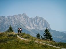
Comfortable round with a magnificent view of the Hohe Salve.
Mountain station gondola Hexenwasser, Söll (1,150 m)
Mountain station gondola Hexenwasser, Söll (1,150 m)
Wandelen
Gemakkelijk
0:35 u
1,8 km
50 Hoogtemeters

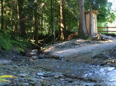
Hikers, young and old alike, will find in this wild romantic gorge natural playgrounds such as bridges and balancing beams by streams and ponds.
Hiking starting point Tourist Info, Scheffau (738 m)
Hiking starting point Tourist Info, Scheffau (738 m)
Wandelen
Gemakkelijk
1:15 u
3,5 km
130 Hoogtemeters

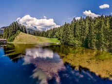
The best hiking routes from village centre Scheffau to Lake Hinterstein.
Community Hall, Scheffau (740 m)
Hintersteiner See, Scheffau (890 m)
Wandelen
Normaal
1:30 u
4,5 km
240 Hoogtemeters

Beautiful, Alpine sport climbing with consistent difficulty.
Alpine klimroutes

Winter hike with picturesque views of the Wilder Kaiser to the 'Wolfsegg' plateau
Hiking starting point Going center (former tourist information Going) (764 m)
Hiking starting point Going center (former tourist information Going) (764 m)
Wandelen
1:30 u
4,0 km
65 Hoogtemeters

A winter hiking route connects the villages of Söll and Scheffau.
Hiking starting point Tourist Info, Scheffau (737 m)
Hiking starting point Tourist Info, Söll (689 m)
Wandelen
2:45 u
7,1 km
70 Hoogtemeters

Soccer field, Söll (687 m)
Soccer field, Söll (687 m)
Hardlopen
Gemakkelijk
2,5 km
30 Hoogtemeters

Details about the Kaiserkrone Trail - Trailrunning Event at: www.kaiserkrone.run
Start & Finish - village center of Scheffau (732 m), address: Dorf 45, 6351 Scheffau
Start & Finish - village center of Scheffau (732 m), address: Dorf 45, 6351 Scheffau
Hardlopen
Moeilijk
56,0 km
3640 Hoogtemeters

Nice circular hike through Going with visits to numerous chapels.
Hiking starting point Going center (former tourist information Going) (764 m)
Hiking starting point Going center (former tourist information Going) (764 m)
Wandelen
Gemakkelijk
2:45 u
9,3 km
210 Hoogtemeters
 Gedeeltelijk open
This familyfriendly hike leads you along the panoramic trail from the Brandstadl mountain in Scheffau to the Hartkaiser mountain in Ellmau.
Brandstadlbahn mountain station, Scheffau (1,650 m) or Hartkaiserbahn mountain station, Ellmau (1.550 m)
Brandstadlbahn mountain station, Scheffau (1,650 m) or Hartkaiserbahn mountain station, Ellmau (1.550 m)
Wandelen
Gemakkelijk
1:50 u
6,0 km
170 Hoogtemeters
Quietness, strength and with easy breathing steadily closer to the Wilder Kaiser. You can return on foot or by bus.
Hiking starting point Bergbahn, Söll (724 m)
Gasthof Bocking, Söll (665 m)
Wandelen
Gemakkelijk
1:45 u
5,5 km
100 Hoogtemeters

Shady hike with idyllic resting places and views from the Zillertaler Alpen to the Inn valley.
Hiking starting point Alpenschlössl, Söll (762 m)
Hiking starting point Alpenschlössl, Söll (762 m)
Wandelen
Gemakkelijk
3:30 u
9,5 km
480 Hoogtemeters

A tour for experienced bikers in the Kaiser's Alpine pasture area.
Community Hall, Scheffau (740 m)
Community Hall, Scheffau (740 m)
Fietsen
Moeilijk
21,3 km
690 Hoogtemeters

There are 3 steep rises which are moderable with e-bikes.
Cable car valley station, Söll (725 m)
Au Hoch-Alm, Söll (1.600 m)
Fietsen
Normaal
8,9 km
860 Hoogtemeters

The Hintere Goinger Halt (2,193 m) is considered to be the easiest summit to reach in the Wilder Kaiser.
Hiking starting point Wochenbrunner Alm, Ellmau (1,085 m)
Hiking starting point Wochenbrunner Alm, Ellmau (1,085 m)
Wandelen
Moeilijk
6:30 u
8,9 km
1090 Hoogtemeters

Grey skies and rain are no excuse: keen climbers have plenty of opportunities to push their boundaries even indoors.
Kletterhalle

Wonderful winter hike on the sunny side of the valley and easy return to the starting point by bus.
Hiking starting point Tourist Information Office, Ellmau (800 m)
Hiking starting point Tourist Information Office, Scheffau (737 m)
Wandelen
2:15 u
6,1 km
40 Hoogtemeters

On the north side up to the Ellmauer Halt summit 2,344 m.
Via ferrata
 Gedeeltelijk open
Going, Hüttling - Schleierwasserfall - Obere Regalm - Baumgartenköpfl (Bergsteigergrab) - Gaudeamushütte - Ellmauer Tor - Hintere Goinger Halt - Jubiläumssteig - Gruttenhütte - Kaiser-Hochalm - Steiner-Hochalm - Hinterschießling Alm - Rehbachklamm - Scheffau, Dorf
Hiking starting point Hüttling, Going (820 m)
Scheffau village (738 m)
Wandelen
Moeilijk
14:00 u
24,6 km
2060 Hoogtemeters

The most adventurous route to the highest hut on the Wilder Kaiser.
Wochenbrunner Alm, Ellmau (1,085 m)
Wochenbrunner Alm, Ellmau (1,085 m)
Wandelen
Normaal
3:15 u
5,5 km
550 Hoogtemeters

Strength is born of calmness – and the summit cross of the Brandstadl is no exception
Cable car valley station, Söll (725 m)
Cable car valley station, Söll (725 m)
Wandelen
Normaal
3:00 u
5,6 km
910 Hoogtemeters
 Open
OpenVia ferrata

A scenic circuit past Gieringer Weiher pond, Schwarzsee lake and Going bathing lake.
Tourist Info, Going (764 m)
Tourist Info, Going (764 m)
Fietsen
Normaal
40,1 km
460 Hoogtemeters
From the flowery village to the water jewel of the Alps.
Hiking starting point Franzlhof, Söll (703 m)
Seestüberl restaurant, Hintersteiner See, Scheffau (890 m)
Wandelen
Normaal
3:15 u
9,5 km
460 Hoogtemeters

Picture-book cross-country skiing through the farm village with the mountain very close.
Hiking starting point Going Center (former Tourist informatin Going)
Hiking starting point Going Center (former Tourist informatin Going)
Langlaufen
Gemakkelijk
3,9 km
60 Hoogtemeters
 Gedeeltelijk open
Gruttenhütte - Kaiser-Hochalm - Steiner-Hochalm - Hinterschießling Alm - Rehbachklamm - Scheffau, Dorf
Gruttenhütte, Ellmau (1,620 m)
Scheffau village (889 m)
Wandelen
Normaal
4:30 u
11,4 km
190 Hoogtemeters

Moorland hike suitable for children. Discover the special inhabitants of the moor with Törfchen, the moor elf.
Römerhof, St. Johann (769 m)
Römerhof, St. Johann (769 m)
Wandelen
Gemakkelijk
1:30 u
4,3 km
100 Hoogtemeters

Stripsenjochhaus – Eggersteig – Steinerne Rinne – Ellmauer Tor – Jubiläumssteig – Gruttenhütte
Stripsenjochhaus, St. Johann in Tirol (1,577 m)
Gaudeamushütte, Going (1,263 m)
Wandelen
Moeilijk
5:00 u
6,3 km
590 Hoogtemeters
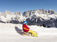
A mountain with lots of tobogganing options and good refreshment stops.
Astbergbahn Talstation, Going (805 m)
Astbergbahn Talstation, Going (805 m)
Rodelen
Normaal
3,0 km

Kaindlhütte - Bettlersteig - Anton-Karg-Haus - Hans-Berger-Haus - Stripsenjochhaus
Hintersteiner See, Scheffau (889 m)
Stripsenjochhaus, St. Johann in Tirol (1,577 m)
Wandelen
Normaal
5:00 u
9,3 km
840 Hoogtemeters

Explore the sunny foot of the Pölven mountain.
Hiking starting point Franzlhof, Söll (703 m)
Hiking starting point Franzlhof, Söll (703 m)
Wandelen
2:30 u
6,8 km
100 Hoogtemeters
Easy snowshoe hike at the foot of the Wilder Kaiser.
Postbus stop Dorf/Bauhof, Ellmau
Postbus stop Dorf/Bauhof, Ellmau
Wandelen
0:40 u
1,3 km
10 Hoogtemeters

Refreshing walk through the Kneipp circuit and adventures in the Rehbachklamm gorge
Hiking starting point Tourist Info, Scheffau (738 m)
Hiking starting point Tourist Info, Scheffau (738 m)
Wandelen
Normaal
2:00 u
7,1 km
330 Hoogtemeters

Skiing or hiking on the cross-country trail isn’t possible when there’s been too little snow on the sunny side. In this case there’s a perfectly prepared trail available on the shaded side - the Dorfloipe Going.
Infobüro Going,
Wanderstartplatz Infobüro, Going (764 m)
Langlaufen
Gemakkelijk
1,4 km
20 Hoogtemeters

Ellmau Tourist Information Office - golf course - Wochenbrunner Alm
Tourist Information Office, Ellmau (800 m)
Wochenbrunner Alm, Ellmau (1,085 m)
Fietsen
Normaal
4,8 km
260 Hoogtemeters
Two very demanding, fantastic lookout peaks on the Wilder Kaiser, which are not to be underestimated.
Hiking starting point Wegscheid, Scheffau (883 m)
Hiking starting point Wegscheid, Scheffau (883 m)
Wandelen
Moeilijk
9:00 u
11,0 km
1440 Hoogtemeters

Over hill and dale through idyllic nature up to the Rauhen Kopf.
Astberg Bergstation
Astberg Bergstation
Wandelen
Normaal
4:45 u
13,1 km
620 Hoogtemeters

Gentle cycle tour from Wörgl via Söll, Scheffau, Ellmau and Going to St. Johann or vice versa!
Wörgl (511 m)
St. Johann (660 m)
Fietsen
Normaal
38,3 km
520 Hoogtemeters

Exciting adventure stations for family tobogganing on the Hohe Salve.
Cable car valley station, Söll (725 m)
Cable car valley station, Söll (725 m)
Rodelen
Gemakkelijk
4,0 km
De door u opgevraagde pagina is niet beschikbaar. U bent welkom om een nieuwe zoekopdracht op deze pagina te starten.
Experience culinaric highlights for the whole family.
Bergstation Rabennest (1.150 m)
Bergstation Rabennest (1.150 m)
Wandelen
Gemakkelijk
0:40 u
1,7 km
90 Hoogtemeters
Comfortable round with a magnificent view of the Hohe Salve.
Mountain station gondola Hexenwasser, Söll (1,150 m)
Mountain station gondola Hexenwasser, Söll (1,150 m)
Wandelen
Gemakkelijk
0:35 u
1,8 km
50 Hoogtemeters
Hikers, young and old alike, will find in this wild romantic gorge natural playgrounds such as bridges and balancing beams by streams and ponds.
Hiking starting point Tourist Info, Scheffau (738 m)
Hiking starting point Tourist Info, Scheffau (738 m)
Wandelen
Gemakkelijk
1:15 u
3,5 km
130 Hoogtemeters
The best hiking routes from village centre Scheffau to Lake Hinterstein.
Community Hall, Scheffau (740 m)
Hintersteiner See, Scheffau (890 m)
Wandelen
Normaal
1:30 u
4,5 km
240 Hoogtemeters
Beautiful, Alpine sport climbing with consistent difficulty.
Alpine klimroutes
Winter hike with picturesque views of the Wilder Kaiser to the 'Wolfsegg' plateau
Hiking starting point Going center (former tourist information Going) (764 m)
Hiking starting point Going center (former tourist information Going) (764 m)
Wandelen
1:30 u
4,0 km
65 Hoogtemeters
A winter hiking route connects the villages of Söll and Scheffau.
Hiking starting point Tourist Info, Scheffau (737 m)
Hiking starting point Tourist Info, Söll (689 m)
Wandelen
2:45 u
7,1 km
70 Hoogtemeters
Soccer field, Söll (687 m)
Soccer field, Söll (687 m)
Hardlopen
Gemakkelijk
2,5 km
30 Hoogtemeters
Details about the Kaiserkrone Trail - Trailrunning Event at: www.kaiserkrone.run
Start & Finish - village center of Scheffau (732 m), address: Dorf 45, 6351 Scheffau
Start & Finish - village center of Scheffau (732 m), address: Dorf 45, 6351 Scheffau
Hardlopen
Moeilijk
56,0 km
3640 Hoogtemeters
Nice circular hike through Going with visits to numerous chapels.
Hiking starting point Going center (former tourist information Going) (764 m)
Hiking starting point Going center (former tourist information Going) (764 m)
Wandelen
Gemakkelijk
2:45 u
9,3 km
210 Hoogtemeters
Gedeeltelijk openThis familyfriendly hike leads you along the panoramic trail from the Brandstadl mountain in Scheffau to the Hartkaiser mountain in Ellmau.
Brandstadlbahn mountain station, Scheffau (1,650 m) or Hartkaiserbahn mountain station, Ellmau (1.550 m)
Brandstadlbahn mountain station, Scheffau (1,650 m) or Hartkaiserbahn mountain station, Ellmau (1.550 m)
Wandelen
Gemakkelijk
1:50 u
6,0 km
170 Hoogtemeters
Quietness, strength and with easy breathing steadily closer to the Wilder Kaiser. You can return on foot or by bus.
Hiking starting point Bergbahn, Söll (724 m)
Gasthof Bocking, Söll (665 m)
Wandelen
Gemakkelijk
1:45 u
5,5 km
100 Hoogtemeters
Shady hike with idyllic resting places and views from the Zillertaler Alpen to the Inn valley.
Hiking starting point Alpenschlössl, Söll (762 m)
Hiking starting point Alpenschlössl, Söll (762 m)
Wandelen
Gemakkelijk
3:30 u
9,5 km
480 Hoogtemeters
A tour for experienced bikers in the Kaiser's Alpine pasture area.
Community Hall, Scheffau (740 m)
Community Hall, Scheffau (740 m)
Fietsen
Moeilijk
21,3 km
690 Hoogtemeters
There are 3 steep rises which are moderable with e-bikes.
Cable car valley station, Söll (725 m)
Au Hoch-Alm, Söll (1.600 m)
Fietsen
Normaal
8,9 km
860 Hoogtemeters
The Hintere Goinger Halt (2,193 m) is considered to be the easiest summit to reach in the Wilder Kaiser.
Hiking starting point Wochenbrunner Alm, Ellmau (1,085 m)
Hiking starting point Wochenbrunner Alm, Ellmau (1,085 m)
Wandelen
Moeilijk
6:30 u
8,9 km
1090 Hoogtemeters
Grey skies and rain are no excuse: keen climbers have plenty of opportunities to push their boundaries even indoors.
Kletterhalle
Wonderful winter hike on the sunny side of the valley and easy return to the starting point by bus.
Hiking starting point Tourist Information Office, Ellmau (800 m)
Hiking starting point Tourist Information Office, Scheffau (737 m)
Wandelen
2:15 u
6,1 km
40 Hoogtemeters
On the north side up to the Ellmauer Halt summit 2,344 m.
Via ferrata
Gedeeltelijk openGoing, Hüttling - Schleierwasserfall - Obere Regalm - Baumgartenköpfl (Bergsteigergrab) - Gaudeamushütte - Ellmauer Tor - Hintere Goinger Halt - Jubiläumssteig - Gruttenhütte - Kaiser-Hochalm - Steiner-Hochalm - Hinterschießling Alm - Rehbachklamm - Scheffau, Dorf
Hiking starting point Hüttling, Going (820 m)
Scheffau village (738 m)
Wandelen
Moeilijk
14:00 u
24,6 km
2060 Hoogtemeters
The most adventurous route to the highest hut on the Wilder Kaiser.
Wochenbrunner Alm, Ellmau (1,085 m)
Wochenbrunner Alm, Ellmau (1,085 m)
Wandelen
Normaal
3:15 u
5,5 km
550 Hoogtemeters
Strength is born of calmness – and the summit cross of the Brandstadl is no exception
Cable car valley station, Söll (725 m)
Cable car valley station, Söll (725 m)
Wandelen
Normaal
3:00 u
5,6 km
910 Hoogtemeters
OpenVia ferrata
A scenic circuit past Gieringer Weiher pond, Schwarzsee lake and Going bathing lake.
Tourist Info, Going (764 m)
Tourist Info, Going (764 m)
Fietsen
Normaal
40,1 km
460 Hoogtemeters
From the flowery village to the water jewel of the Alps.
Hiking starting point Franzlhof, Söll (703 m)
Seestüberl restaurant, Hintersteiner See, Scheffau (890 m)
Wandelen
Normaal
3:15 u
9,5 km
460 Hoogtemeters
Picture-book cross-country skiing through the farm village with the mountain very close.
Hiking starting point Going Center (former Tourist informatin Going)
Hiking starting point Going Center (former Tourist informatin Going)
Langlaufen
Gemakkelijk
3,9 km
60 Hoogtemeters
Gedeeltelijk openGruttenhütte - Kaiser-Hochalm - Steiner-Hochalm - Hinterschießling Alm - Rehbachklamm - Scheffau, Dorf
Gruttenhütte, Ellmau (1,620 m)
Scheffau village (889 m)
Wandelen
Normaal
4:30 u
11,4 km
190 Hoogtemeters
Moorland hike suitable for children. Discover the special inhabitants of the moor with Törfchen, the moor elf.
Römerhof, St. Johann (769 m)
Römerhof, St. Johann (769 m)
Wandelen
Gemakkelijk
1:30 u
4,3 km
100 Hoogtemeters
Stripsenjochhaus – Eggersteig – Steinerne Rinne – Ellmauer Tor – Jubiläumssteig – Gruttenhütte
Stripsenjochhaus, St. Johann in Tirol (1,577 m)
Gaudeamushütte, Going (1,263 m)
Wandelen
Moeilijk
5:00 u
6,3 km
590 Hoogtemeters
A mountain with lots of tobogganing options and good refreshment stops.
Astbergbahn Talstation, Going (805 m)
Astbergbahn Talstation, Going (805 m)
Rodelen
Normaal
3,0 km
Kaindlhütte - Bettlersteig - Anton-Karg-Haus - Hans-Berger-Haus - Stripsenjochhaus
Hintersteiner See, Scheffau (889 m)
Stripsenjochhaus, St. Johann in Tirol (1,577 m)
Wandelen
Normaal
5:00 u
9,3 km
840 Hoogtemeters
Explore the sunny foot of the Pölven mountain.
Hiking starting point Franzlhof, Söll (703 m)
Hiking starting point Franzlhof, Söll (703 m)
Wandelen
2:30 u
6,8 km
100 Hoogtemeters
Easy snowshoe hike at the foot of the Wilder Kaiser.
Postbus stop Dorf/Bauhof, Ellmau
Postbus stop Dorf/Bauhof, Ellmau
Wandelen
0:40 u
1,3 km
10 Hoogtemeters
Refreshing walk through the Kneipp circuit and adventures in the Rehbachklamm gorge
Hiking starting point Tourist Info, Scheffau (738 m)
Hiking starting point Tourist Info, Scheffau (738 m)
Wandelen
Normaal
2:00 u
7,1 km
330 Hoogtemeters
Skiing or hiking on the cross-country trail isn’t possible when there’s been too little snow on the sunny side. In this case there’s a perfectly prepared trail available on the shaded side - the Dorfloipe Going.
Infobüro Going,
Wanderstartplatz Infobüro, Going (764 m)
Langlaufen
Gemakkelijk
1,4 km
20 Hoogtemeters
Ellmau Tourist Information Office - golf course - Wochenbrunner Alm
Tourist Information Office, Ellmau (800 m)
Wochenbrunner Alm, Ellmau (1,085 m)
Fietsen
Normaal
4,8 km
260 Hoogtemeters
Two very demanding, fantastic lookout peaks on the Wilder Kaiser, which are not to be underestimated.
Hiking starting point Wegscheid, Scheffau (883 m)
Hiking starting point Wegscheid, Scheffau (883 m)
Wandelen
Moeilijk
9:00 u
11,0 km
1440 Hoogtemeters
Over hill and dale through idyllic nature up to the Rauhen Kopf.
Astberg Bergstation
Astberg Bergstation
Wandelen
Normaal
4:45 u
13,1 km
620 Hoogtemeters
Gentle cycle tour from Wörgl via Söll, Scheffau, Ellmau and Going to St. Johann or vice versa!
Wörgl (511 m)
St. Johann (660 m)
Fietsen
Normaal
38,3 km
520 Hoogtemeters
Exciting adventure stations for family tobogganing on the Hohe Salve.
Cable car valley station, Söll (725 m)
Cable car valley station, Söll (725 m)
Rodelen
Gemakkelijk
4,0 km